The Rio Chama below Abiquiu Dam is an incredibly unique geomorphic reach. Due to the control and mitigation of peak flows by Abiquiu Dam and the 47 tributary arroyos that bring sediment into the Chama, the channel has been downsizing. The surface geology surrounding this reach is the Santa Fe formation which consists of highly erodible sands and gravel. At 1800 cfs, which is the maximum allowable discharge rate out of Abiquiu Dam, there is not enough energy in the river to carry these larger sediments, thus they get deposited in the channel, reducing the channel capacity. The Chama delivers approximately 1.5 million tons of suspended sediment to the Rio Grande every year, most of this is smaller materials (Graf,1994). This flushing of smaller sediments has resulted in bed material coursening (Harvey,2018)- it is important to understand that as this process continues the channel's capacity will decrease until the 1800 cfs max is too high, and will have to be lowered, resulting in an exponential feedback loop continuing until the river inevitably dries up.
Usually when a dam is constructed, the downstream reach becomes sediment starved and the river begins to erode the banks uncontrollably, but the opposite has happened in the Rio Chama. The river’s channel capacity is decreasing and has caused the system to be even more vulnerable to natural flood events. This feedback loop of no flood flows and excess sediment is the single greatest threat to longevity of the river and the natural and human systems that rely on it.
The paradox of this reach is that the resilience of the diversion structures and the resilience of the river are inversely related. Before Abiquiu Dam was constructed, peak flows in the lower reach were 3,700 cfs annually. The acequia system was constructed to withstand these peak flows, but since Abiquiu, flood flows have been inhibited, and the acequia system has not been maintained to withstand these peak flows (USACE,1996). Acequias are now stressed at ~1600 cfs, because of this loss of resilience, the acequia system is extremely vulnerable to flooding, but steps can be taken to increase their ability to absorb flood flows.
In order to flush out the sediment that has been deposited and get the river to a more equilibrated state, high flows will have to come down the river which leaves the people and their diversion structures vulnerable to be flooded or washed out. Steps must be taken to increase the structural integrity of the acequias and their diversion structures, so that controlled floods flows can safely come down the river.
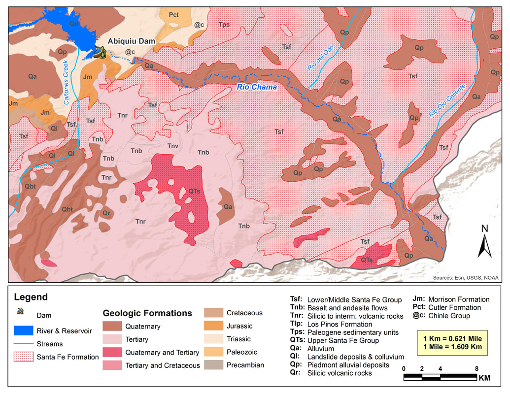
Map: Lower Rio Chama Geologic Formations
The above map highlights the location of the highly erodible Santa Fe Formation in the lower Rio Chama region. The riverbed of the lower Rio Chama consists of alluvium and piedmont alluvial deposits. Another geologic feature worth noting in this area is the Morrison Formation, which is more present in the upper Rio Chama region but located only around the Abiquiu Dam in the lower section. The Morrison Formation is composed of mudstone, siltstone, sandstone and limestone and is most commonly known for the presence of Jurassic-period fossils.
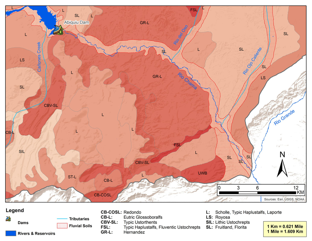
Map: Lower Rio Chama Soil Types
The above map shows the variety of soil types in the lower Rio Chama region. The Florida and Fruitland series make up the fluvial soils in this section of the Rio Chama.
References
- USACE. 1996. Rio Chama Abiquiu Dam to Espanola New Mexico, Reconnaissance Report.
- Graf, W.L., 1994. Plutonium and the Rio Grande: Environmental change and contamination in the nuclear age. Oxford University Press, New York,
- Harvey, M. 2018. Rio Chama Acequias Abiquiu Dam to Chamita [Powerpoint Slides].