Flood risk management is a very convoluted problem on the Rio Chama. The completion of Abiquiu Dam in 1963 brought a sense of safety and stability to the historic flood plain on the lower reach of the Rio Chama (USACE, 1996). This sense of safety has thus brought about new development in the floodplain and has allowed cultural infrastructure to continue servicing the farmers of the region with less upkeep than previously required. These factors, along with the mitigation of peak flows, have created a dangerous feedback loop of diminishing channel capacity and less resilient infrastructure. During the New Mexico's monsoon season, tributaries such as El Rito, Rio Del Oso, and Rio Ojo Caliente, bring both high flows and large amount of sediment to the Chama's channel. As sediment is continually deposited, the channel's capacity decreases making the floodplain more vulnerable to flooding. These problems are now accentuated by climate change as rains come less often but more intense and snowpack melts faster and earlier, both of which increase the chances of flooding if they were to occur below Abiquiu Dam. The sustained “exceptional drought” in the region also increases the risk of wildfire which would be catastrophic to general watershed health and increase the chances of deadly and destructive debris flows.
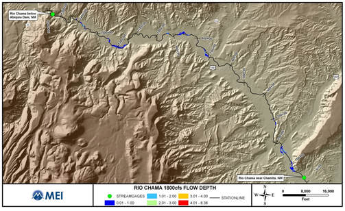
Rio Chama at 1800 cfs.
292 acres of overbank flooding
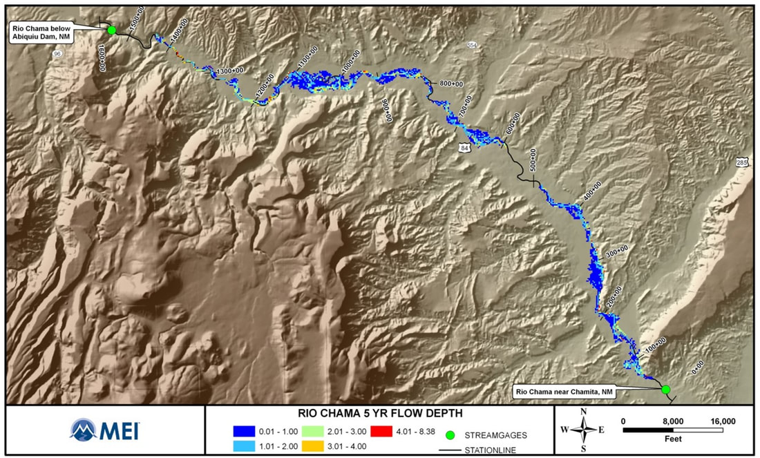
Rio Chama at 3740 cfs. 5yr flood event. 2540 acres of overbank flooding.
|
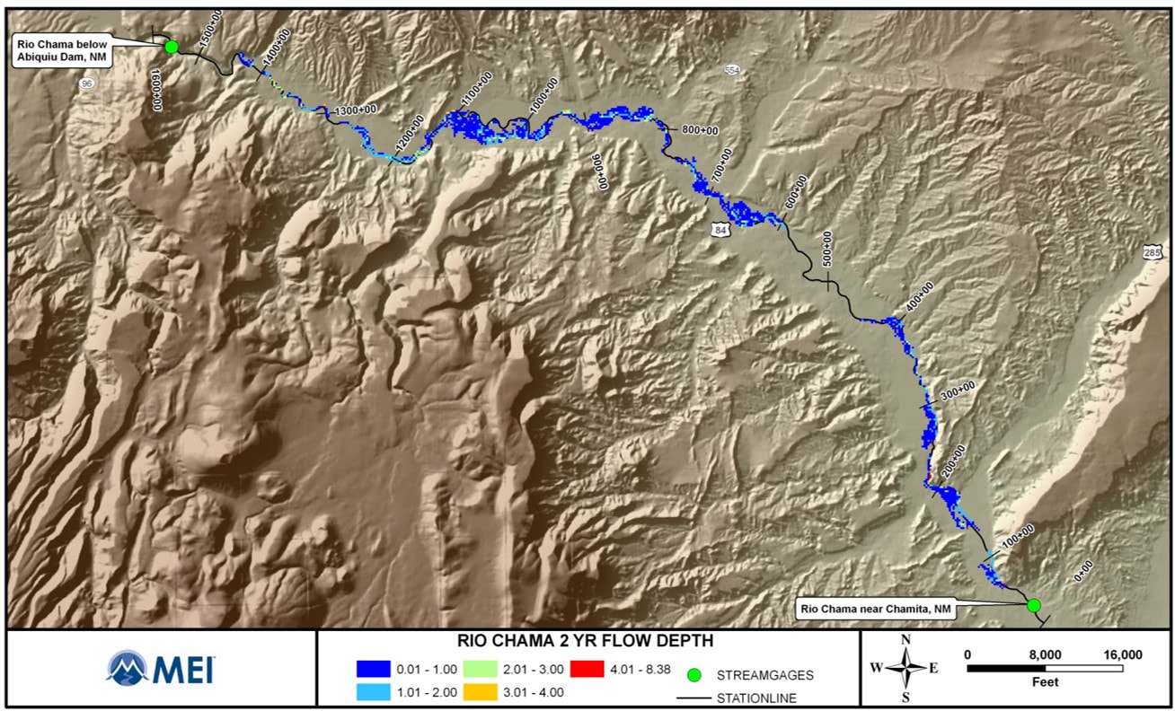
Rio Chama at 3010cfs. 2yr flood event. 1680 acres of overbank flooding.
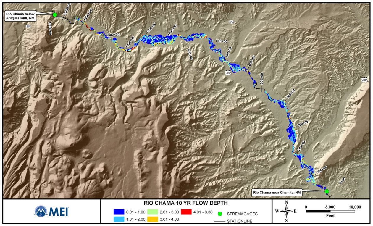
Rio Chama at 4190 cfs. 10yr flood event. 3100 acres of overbank flooding.
|
References
Harvey, M. 2018.Rio Chama Acequias Abiquiu Dam to Chamita [Powerpoint Slides].
USACE. 1996. Rio Chama Abiquiu Dam to Espanola New Mexico, Reconnaissance Report.
Harvey, M. 2018.Rio Chama Acequias Abiquiu Dam to Chamita [Powerpoint Slides].
USACE. 1996. Rio Chama Abiquiu Dam to Espanola New Mexico, Reconnaissance Report.